名前
ST_Clip — 入力ジオメトリで切り取ったラスタを返します。バンドが指定されていない場合には、全てのバンドが返されます。cropが指定されていない場合には、TRUEと仮定され、出力ラスタをクロップします。
概要
raster ST_Clip(raster rast, integer[] nband, geometry geom, double precision[] nodataval=NULL, boolean crop=TRUE);
raster ST_Clip(raster rast, integer nband, geometry geom, double precision nodataval, boolean crop=TRUE);
raster ST_Clip(raster rast, integer nband, geometry geom, boolean crop);
raster ST_Clip(raster rast, geometry geom, double precision[] nodataval=NULL, boolean crop=TRUE);
raster ST_Clip(raster rast, geometry geom, double precision nodataval, boolean crop=TRUE);
raster ST_Clip(raster rast, geometry geom, boolean crop);
説明
入力ジオメトリgeomで切り取ったラスタを返します。バンドが指定されていない場合には、全てのバンドが処理されます。
ST_Clipが返すラスタは、バンド毎に一つずつ必ず切り取った領域に適用するNODATA値を持ちます。NODATA値が渡されず、入力ラスタがNODATA値を持たない場合には、結果ラスタのNODATA値はST_MinPossibleValue(ST_BandPixelType(rast, band))に設定されます。配列におけるNODATA値の要素数がバンド数より小さい場合には、配列の最後の要素が残りのバンドに適用されます。NODATA値の要素数がバンド数より多い場合には、超過分は無視されます。全てのNODATA値配列を受け付ける形式では、バンド毎に適用される単一値も受け付けます。
cropが指定されていない場合には、TRUEと仮定され、出力ラスタを geom範囲とrast範囲とのインタセクトした範囲にクロップします。cropがFALSEに設定されている場合には、新しいラスタはrastと同じ範囲になります。
Availability: 2.0.0
Enhanced: 2.1.0 C言語で記述されました
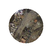
MassGISサイトMassGIS Aerial Orthosにあるマサチューセッツ空中写真データを使った例です。座標はメートル単位のマサチューセッツ州平面です。
例: 1バンドの切り取り
-- Clip the first band of an aerial tile by a 20 meter buffer.
SELECT ST_Clip(rast, 1,
        ST_Buffer(ST_Centroid(ST_Envelope(rast)),20)
    ) from aerials.boston
WHERE rid = 4;
-- Demonstrate effect of crop on final dimensions of raster
-- Note how final extent is clipped to that of the geometry
-- if crop = true
SELECT ST_XMax(ST_Envelope(ST_Clip(rast, 1, clipper, true))) As xmax_w_trim,
    ST_XMax(clipper) As xmax_clipper,
    ST_XMax(ST_Envelope(ST_Clip(rast, 1, clipper, false))) As xmax_wo_trim,
    ST_XMax(ST_Envelope(rast)) As xmax_rast_orig
FROM (SELECT rast, ST_Buffer(ST_Centroid(ST_Envelope(rast)),6) As clipper
    FROM aerials.boston
WHERE rid = 6) As foo;

   xmax_w_trim    |   xmax_clipper   |   xmax_wo_trim   |  xmax_rast_orig
------------------+------------------+------------------+------------------
 230657.436173996 | 230657.436173996 | 230666.436173996 | 230666.436173996
|
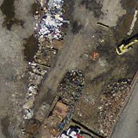 切り取り前の完全なラスタタイル
|
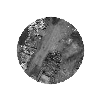 切り取り後
|
例: クロップがなく他のバンドは切り取らず1バンドを切り取る
-- Same example as before, but we need to set crop to false to be able to use ST_AddBand
-- because ST_AddBand requires all bands be the same Width and height
SELECT ST_AddBand(ST_Clip(rast, 1,
        ST_Buffer(ST_Centroid(ST_Envelope(rast)),20),false
    ), ARRAY[ST_Band(rast,2),ST_Band(rast,3)] ) from aerials.boston
WHERE rid = 6;
|
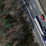 切り取り前の完全なラスタタイル
|
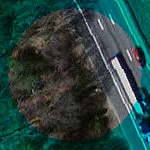 切り取り後 - シュールですね
|
